Glenbow Trail
Quick Facts
Trail Composition
Seasonality
Trail Profile
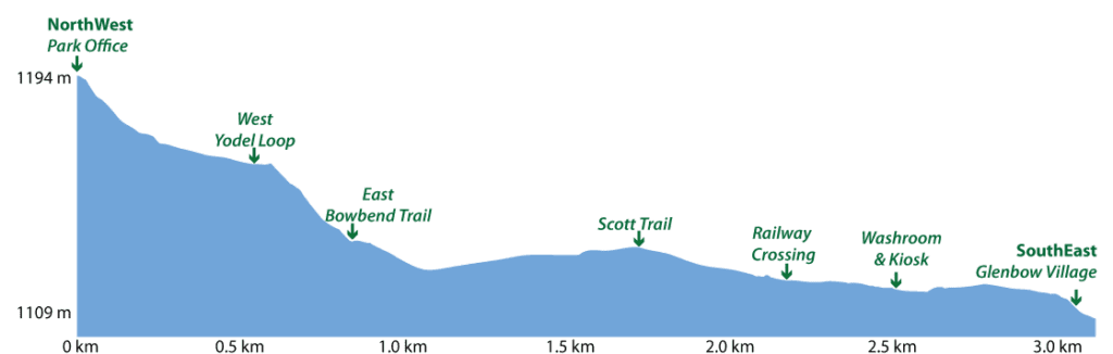
Highest Elevation:
Lowest Elevation:
Trail Details
GlenbowTrail is part of the Park’s main east-west arterial pathway.
Starting at the Parking Lot, Glenbow Trail provides access to Lily Loop and a beautiful west-facing scenic outlook point. The trail passes directly in front of the Park’s Visitor Information Centre where you can drop in to see our interpretive displays and talk to the very helpful staff and volunteers about what the Park offers.
Winding down into the valley bottom, Glenbow Trail passes by trail junctions to Yodel Loop and Bowbend Trail, then turns to the east. From here, the walk is fairly level all the way to the old Glenbow Townsite location.
Stop along the way and take a look at the Park’s engaging interpretive signs that bring to life the area’s natural and cultural resources.
The narrows is a beautiful area of the Park. Here, the river and the valley wall squeeze together in The Narrows – the obvious source of the trail’s name.
The far east end of The Narrows was where the original Canadian Pacific Railway Glenbow Water Tower was located – this making sense of the name Glenbow: Glen meaning a narrow valley, and Bow the name of the valley’s river.
The Narrows is well-known as a good birding area – home to everything from Pileated Woodpeckers, Kingbirds, and a variety of songbirds.